
Sorry to lead with a family snapshot, but there’s a story behind it. That’s me, around 1970, walking through the Red Pine plantation behind our house.
We moved to Canaan (NY) in 1970 and, as a young boy, one of my most vivid memories is of walking through a Red Pine plantation in the woods behind our house. The tall, straight, light-barked trees aligned in regular rows lorded over a clean and cushy covering of pine needles. The combination of surprising, all-encompassing symmetry and a feeling akin to walking on a water mattress made the experience other-worldly.
I did not at the time ask myself where that plantation came from nor where it might be going. Neither my parents nor I had any inkling of a ‘what should we do with it?’ sort of question. And yet, encapsulated in the history of that stand are the histories of many stands throughout the County and perhaps the region – the story of the forgotten tree plantation.

Land Classification Map from the 1941 “Columbia County Agricultural Survey”. The classification was apparently based on a tour of the County. Regions in “Land Class III and higher” were still in active, profitable farming; Land Class IIR was apparently borderline in terms of its farms; most farms in Land Class IR were abandoned or obviously declining. The green dot indicates the location of the Red Pine plantation mentioned in the text.

This map of the extent of agricultural decline across New York comes from Vaughan’s 1928, “Abandoned Farm Areas in New York”, Bulletin 490 of the Cornell Ag. Experiment Station. In most areas, the peak of farmland was around 1880.

Abandoned farmland reverts spontaneously to forest on a Gallatin (Columbia County) hillside in this 1935 image by Rogers McVaugh. Most of the County’s former farmland has returned to forest on its own.
In the late 1800s and early 1900s, New York State land use visionaries, especially those in the eastern half of the State, had a quandary. For a variety of reasons (including the opening up of the fertile Midwest and a large-scale conversion to corn-based dairy), many former farm fields were being abandoned. For example, in 1925 it was estimated by Vaughan that New York had 4,500,000 acres less farmland than in 1880, the approximate peak of agricultural clearing. That amounted to about 15% of the State’s land cover, an area roughly equal to that of Columbia, Greene, Rensselaer, Dutchess, Ulster, Orange, Sullivan, Putnam and Rockland counties combined. In Columbia County alone, we estimate that improved farmland dropped by around 100,000 acres or more than 25% during the same period.
Reforestation was one way to fill this void. As Vaughan also put it, “The vast areas of idle land in the State are not only non-productive but they have a very depressing influence on agriculture and on the State as a whole…. In order that such land be kept from [unprofitable] agricultural production and still not remain idle and unproductive, reforestation has been suggested as the logical remedy.”
Perhaps inspired in part by German forestry, creating plantations became a focus of reforestation efforts. But what to plant? For several reasons, conifers seemed the logical answer: for example, White Pine was an eager old field volunteer, reflecting the ability of pines to grow on open land; pines tended to grow tall and straight in plantations; and the oft-erroneous vision of the primal pine forest perhaps helped to convince foresters of the long-term appropriateness and ease of growing such species. The State grew and planted millions of conifer seedlings. Between 1909 and 1952, over 790,000,000 trees were reportedly distributed. The vast majority of these were conifers, with White Pine, Red Pine, Scotch Pine and Norway Spruce prominent amongst them. Eventually, Red Pine was apparently favored over White Pine because it seemed more resistant to the pests and diseases that killed or, at least, distorted White Pine thereby reducing its timber value.

The distribution of seedlings as part of NYS reforestation efforts from the Atlas of Forestry of New York (1958?) by Neil Stout. A larger circle indicates a larger proportion of seedlings distributed.

European Larch is one conifer sometimes found in plantations. Unlike our other conifers, larch are completely deciduous and drop all of their needles every winter making them resemble dead snags.

Norway Spruce, a relatively common plantation tree, are distinguished by the characteristic drooping of the branches evident in this photo of an open-grown individual.

The White Pines lining this horizon could be those of a plantation, however, closer inspection would reveal that, in this case, they are probably old-field White Pine which spontaneously grew up in a former farm field. Both spontaneous and planted stands of White Pine are common in Columbia County.
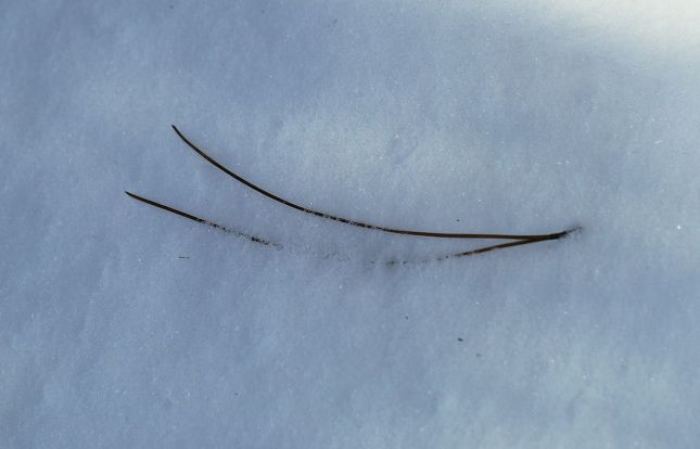
Red Pine plantations can be identified by the red-barked trees evident in the first photo of this posting and the long needles grouped in clusters of two. Scotch Pine, another conifer sometimes found in our plantations, also has paired needles and red bark, but its needles are shorter and twisted.

Although pine plantations can be relatively low in diversity, some wildlife do like to use them for shelter, as evidenced by this string of deer beds.
While some of these plantations were on public land, many trees were distributed free to private land owners and plantations sprang up on farm fields throughout the region. However, as one prescient former DEC employee noted in 1959,
as every plantation owner knows (including the State of New York), with the trees in the ground the work has just begun. .. These plantations have got to be thinned out, just as you would thin out a row of radishes, if you want a good crop at harvesttime. … The problem – and it’s a very big one- is how to pay for these operations…. I can’t help wondering at times if reforestation, as an economic proposition, hasn’t been oversold, or at least misleadingly advertised to the general public. I’ve seen too many plantations, all over the Northeast, put in with a burst of enthusiasm, patriotism, and great expectations-and then left to take care of themselves when the time comes for somebody else to take care of them.
– Pieter W. Fosburgh, 1959, The Natural Thing: The Land and its Citizens.
Indeed, our landscape is now scattered with forgotten, decaying plantations. As the series of images below illustrate, my magical backyard Red Pine stand was no exception.

A 1942 aerial photograph, showing the future Red Pine plantation (circled) still as field.
In 1942 (above), the future location of that ‘home’ Red Pine stand was clearly open field, one of many in this well-worked landscape. Its microtopography suggests that, at least at some point, it was ploughed ground, not just hayfield or pasture.

By the time of this 1952 aerial, the plantation had been planted.

A landscape shot, probably from the early ’50s, with the young Red Pine plantation outlined.
By 1952 (above), however, the field had been planted to Red Pine, probably with funding from New York’s Forest Practice Act of 1946. The thick ‘head’ of trees suggest the seedlings had already been in the ground for a few years when that photograph was taken. An oblique view taken around the same time emphasizes how densely the trees were planted.
These trees continued to mature, and, by 1971 (below), they had formed a well-developed stand. The initial photo in this posting was taken at about this time.

A 1971 aerial of the stand at about the same time that the first photo of this posting was taken from within the stand.

In 1981, the plantation appears to have been generally intact, although a few holes are evident in the pine canopy.
A decade later (above), much of the stand was still intact, although holes had begun to appear. During the 1990s, a storm or storms tore apart the stand, breaking off many trunks. I don’t recall the exact meteorology but I do recall that, over a relatively short period of time, the stand collapsed, a startling glimpse of landscape mortality. By 1995 (below), most of the inner pines had evidently died, resulting in a configuration very similar to today’s.

A false-color image from 1995; the loss of mature trees from the core of the plantation is evident.

This 2017 image, taken during leaf-off, clearly shows that much of the former plantation is now composed of deciduous trees.
The mere ring of remaining pines in today’s stand (above) outlines a deciduous core. This too was a surprise to me. I had come think that pines begat pines, because their needles so acidified the soil as to rule out other sequences. However, if I were to have looked around me while walking through that 1970s stand, I should have grown suspicious – there were, in fact, no young Red Pines waiting to take their place in the slow-motion relay race of tree generations. Once the adult pines began to topple and light reached the ground, a flurry of deciduous trees started to stretch skyward. Today if one looks into the same stand where the initial photograph was taken (below), it requires imagination to believe it was ever a pine stand. True, a few incongruously tall and skinny Red Pines remain, but they are rapidly being enveloped by Sugar Maple and Black Cherry, together with lesser amounts American Beech, Red Maple, Hop Hornbeam, White and Red Oak, White Ash, and a couple of Hickory species.

A photo taken in the Red Pine plantation in early 2018. The main ingredient is no longer Red Pine, although a few of the edge trees are visible in the distance.
This should not have been a surprise. Red Pine is not a common tree in our area; McVaugh’s flora (digitized version courtesy of the NYS Museum), researched during the 1930s, described it as ‘rare’. It is a tree of dry sandy or gravelly soils, not of the loamy soils typical of our Canaan forest. As is true of many plants, that doesn’t mean that, given a head start as this plantation was, Red Pine can’t briefly prosper on a site, but it does mean that, without further human intervention, it will soon lose out to other species which are better able to persist. As a result, barring many new plantings, it is likely that Red Pine, despite its massive inoculation into our flora, will fade away over the coming decades. In fact, we are not sure we have ever found natural Red Pine in Columbia County, although, with a native species like Red Pine, distinguishing natural from planted is not always easy. Not all plantations are set in tidy rows that declare their origins. Aside from checking the soil beneath your feet (is it sandy/gravelly?), a glance at the ground cover may give a hint – according to Fergus (in Trees of New England: A Natural History), a plantation has the typical, pine-needles-only ground cover, whereas a natural stand will likely have populations of acid-tolerant plants such as Star-flower, Blueberry, and Canada Mayflower.
Many stand biographies similar to that outlined here likely exist in the County. We regularly come across fading plantations. They are bittersweet – on the one hand, a dilapidated plantation represents a plan and work that went unrealized; on the other hand, the determination of wild forest to dominate and slowly erase some of our handiwork is encouraging. The mixed forest that emerges will probably be home to a greater diversity of plants and animals than the mono-culture plantation.
And yet, we continue to use wood for paper, fuel and timber. Where should that wood come from?
While it is inconspicuous in some of the above aerials because of its deciduous trees, the plantation lot is bordered to the east by a much older forest that might help inform those questions (below). That adjacent stand had mature trees in the 1942 aerial, and its topography and botany suggest it was never completely cleared. A rocky creek runs through it, springing into being where a gentle dip in the field above it meets the forest land. This is an example of what we call ancient forest – forest that, while some of its individual trees were likely logged, was probably never completely cleared by humans.

A grove of mature trees is evident just to the east of the future location of the pine plantation in this 1942 image. That area remains in forest up to the present day.

A LiDAR image of the topography of the plantation and the adjacent forest. Note how the rocky stream bed ’emerges suddenly’ from the ploughed field north of it. Perhaps such a stream bed once wove all the way down the hillside but was erased by farming.

Looking up the rocky creek just east of the plantation; the ploughed field is visible in the background.
Ancient forests can contain relatively rare soil conditions and an unusual ground flora (although, to be honest, the narrow patch beside the plantation has few documented rarities). Although they are now embedded inconspicuously in a matrix of young, post-agricultural forest regrowth (below), such ancient forests deserve to be identified and given conservation preference. In our region, few if any ancient forest stands are primary or old growth forest, indeed many owe their persistence in the landscape to their role as farm woodlots. As such, some careful, continued use might be appropriate, although especial care should be taken to minimize soil disturbance and avoid the introduction of invasive species. However, the primary focus of wood production should be elsewhere in the landscape.

The greater landscape of the Red Pine plantation in 1942. Note the patches of mature forest (together with some evidently young forest).

The same landscape in 2015 – finding ancient forest fragments in such an extensively reforested landscape can be a challenge.