This past Saturday we led a walk into the southern portion of the Hand Hollow State Forest in New Lebanon. In preparation for that, we did some quick historical research and created some background documentation. This post spices those documents with a few photographs from the site.
For more information on visiting this site, please see the following DEC web site: https://www.dec.ny.gov/lands/101433.html.
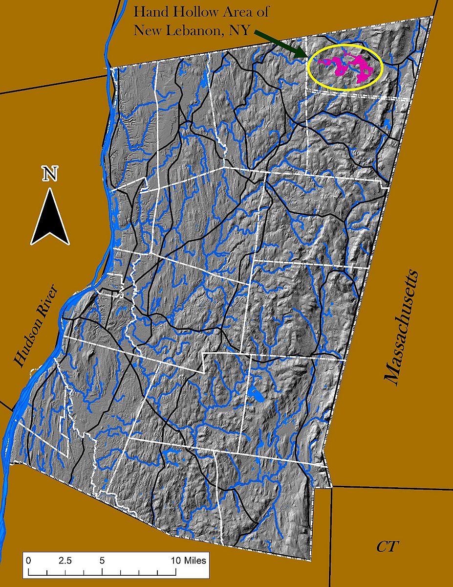
The Hand Hollow State Forest and surrounding public lands are located in the northeastern corner of Columbia County, in the town of New Lebanon, NY, not far from Berkshire County, Massachusetts and in the foothills of the Taconics.
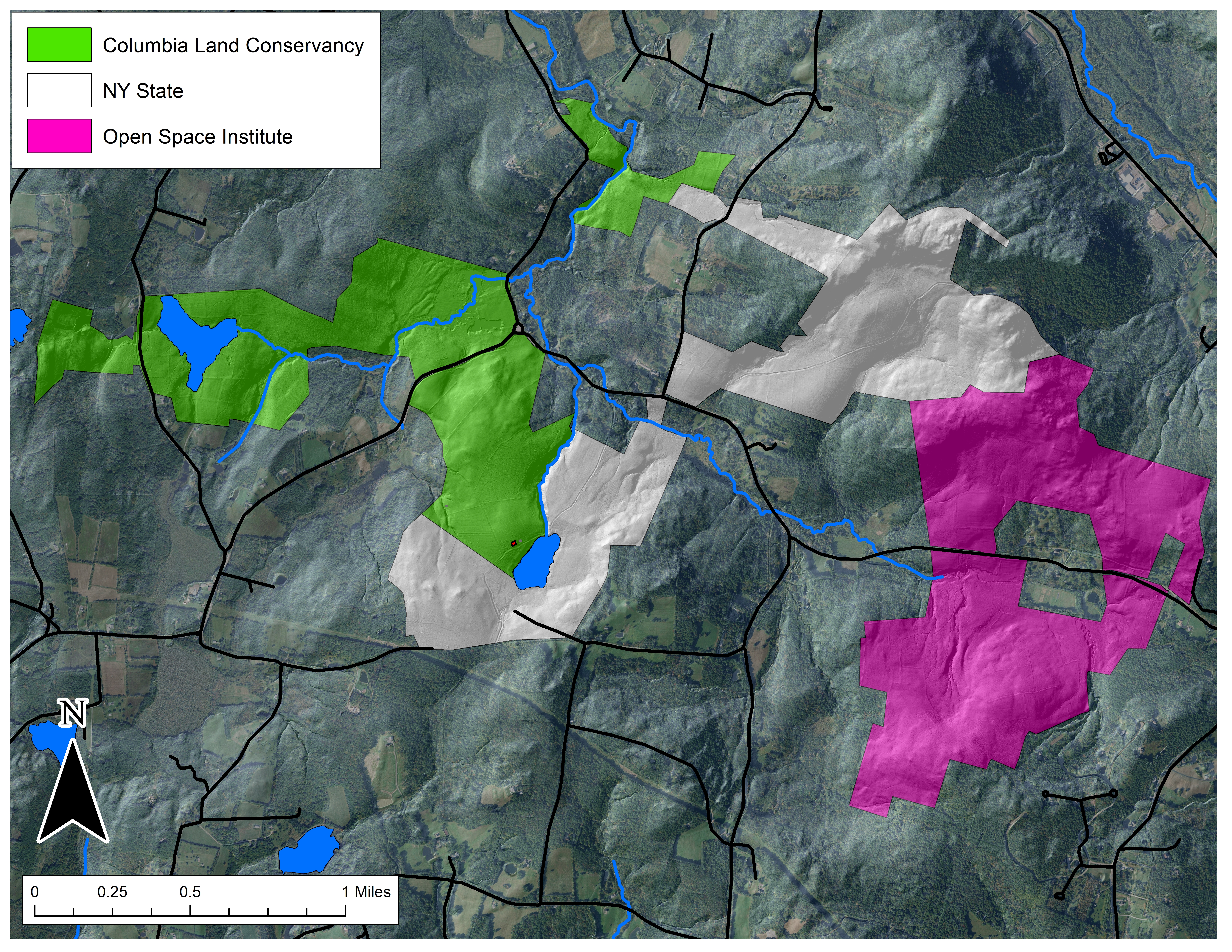 The Hand Hollow State Forest is part of a mosaic of conservation lands in this New Lebanon neighborhood (which was once called New Britain). The Columbia Land Conservancy’s Hand Hollow Conservation Area is to the west, the State Forest itself stretches both north and south of County Route 34, while to the east the Open Space Institute is holding lands earmarked for eventual inclusion in the State Forest.
For more on CLC’s Hand Hollow site, see their web site: https://clctrust.org/public-conservation-areas/hand-hollow/
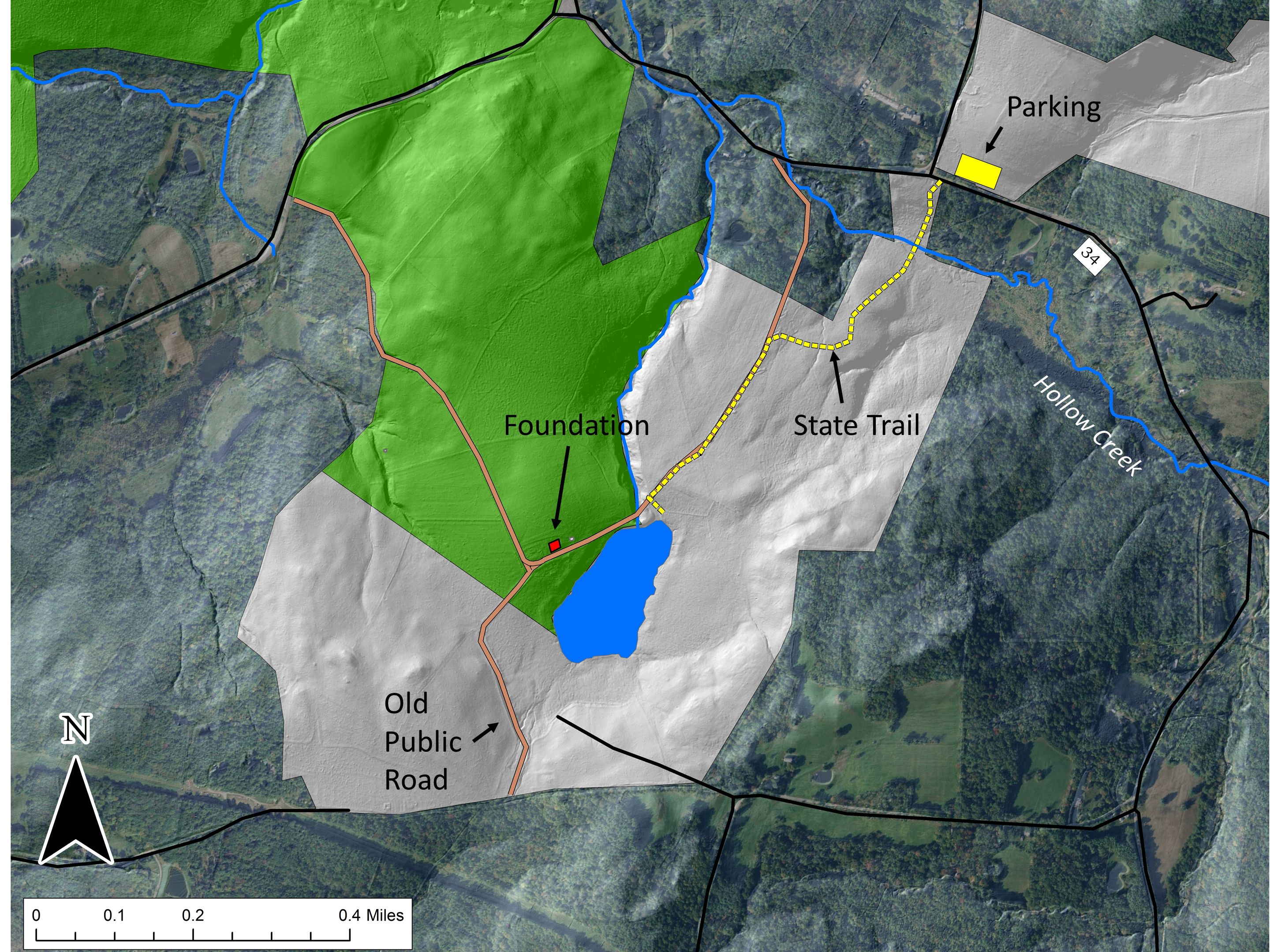 On Saturday last, we walked south from the State Forest parking area north of route 34. The trail weaves its way to the pond, and follows an old public road for its southern half.
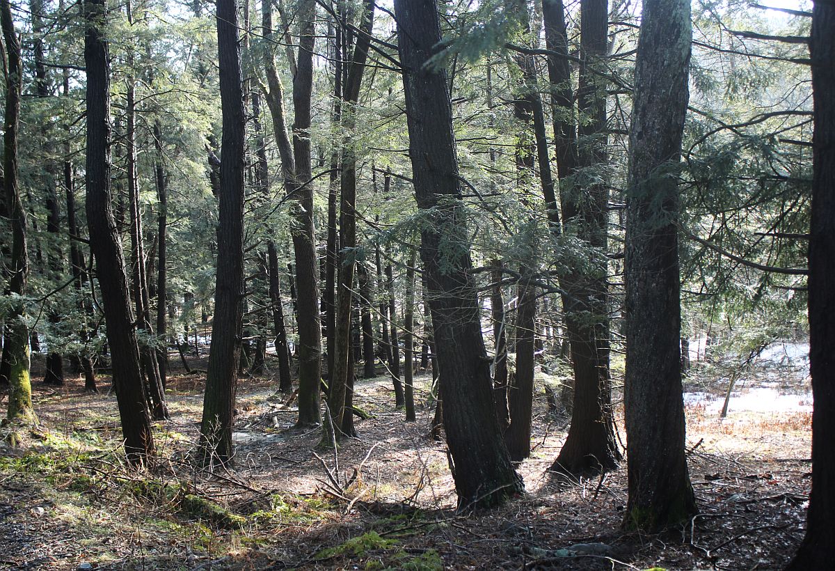 Between route 34 and Hollow Creek is a nice stand of old Hemlock. Judging by size (an admittedly risky criterion) some of these trees may well be over 200 years old. It seems unlikely that this area was ever completely opened, perhaps because it is so wet.
 A bit farther along, the forest was heavily cut over in the early 2000s, but the rough topography and the presence of Yellow Birch and American Beech suggest that this part too was never completely opened for agriculture.
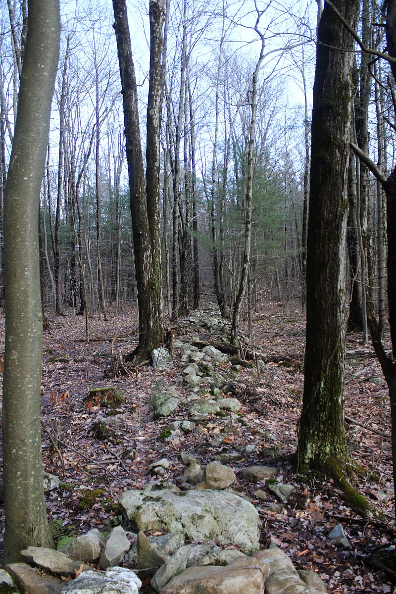
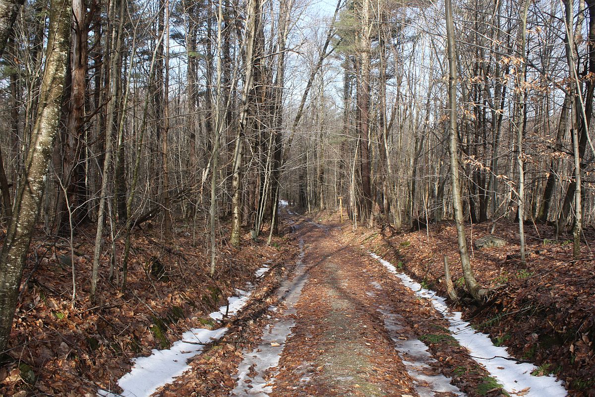 We soon hit the old public road, following its deeply worn, rock-bordered way.
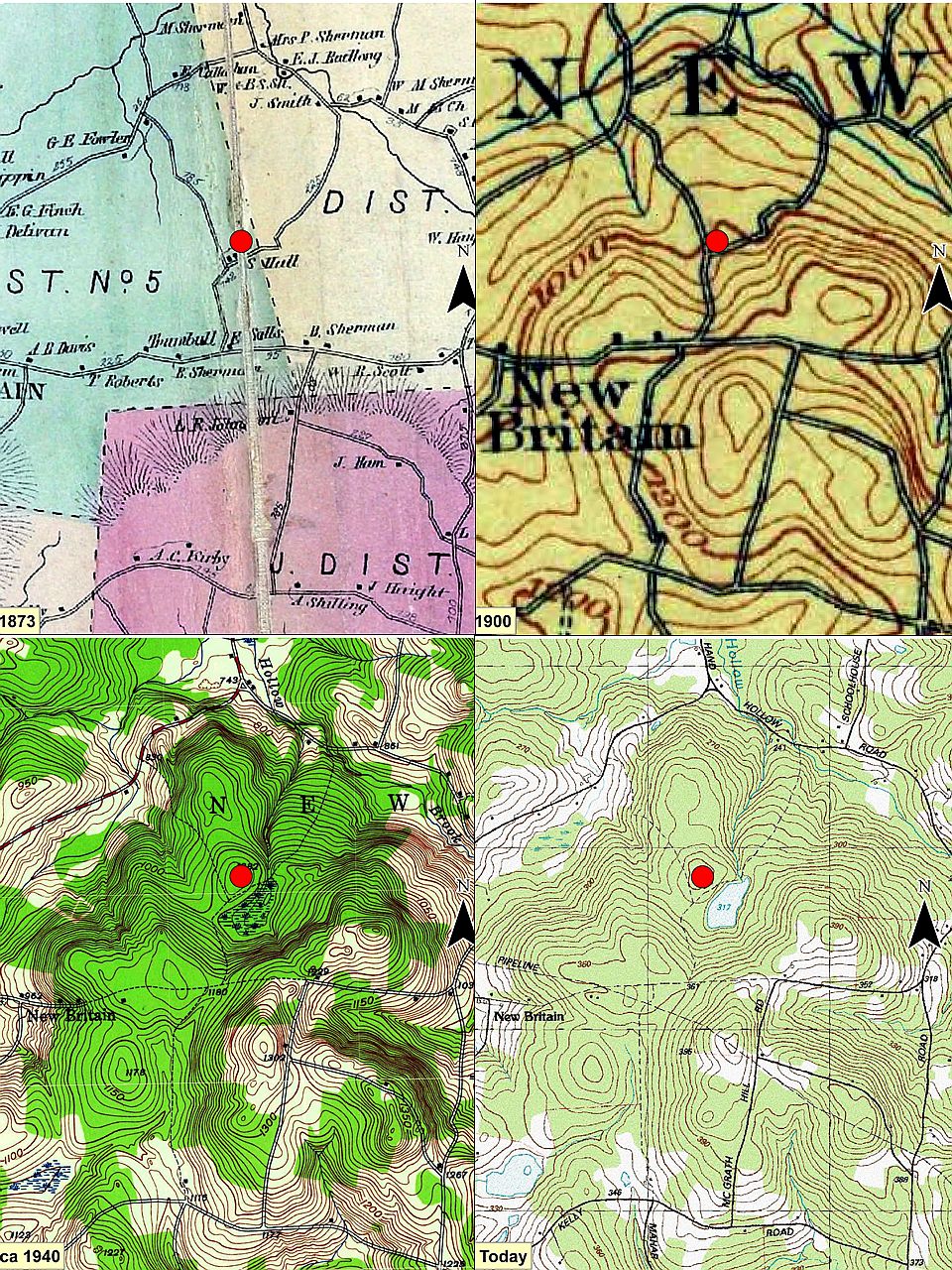 This series of maps show our area starting about 1873 (a map from 1858 is largely similar). The red dot is the house foundation indicated in the second image of this series and located on the north side of what is now the open pond. Notice how the road and some of its connections fade to a dotted shadow and the historical wetland morphs to an open-water pond.
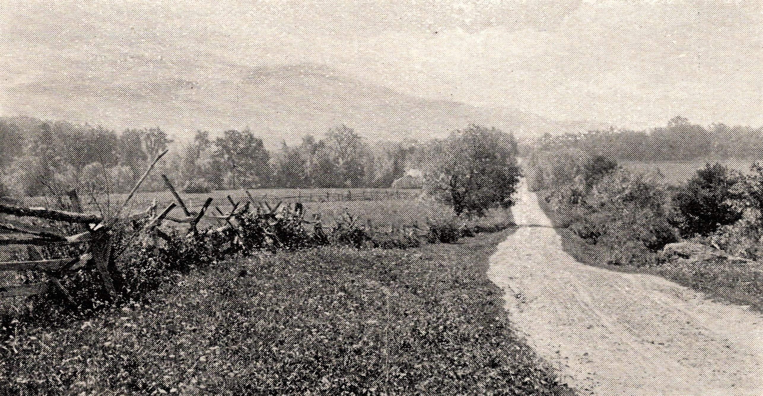 This and the next image are historical road pictures from the early 1890s in adjacent Berkshire County (both are from Picturesque Berkshire). They may give one an idea of what this road looked like. This picture shows a relatively well-kept, probably central road. Notice that the low rock ‘wall’ along the road is topped by a rail and cross posts fence, making it high enough to deter at least some animals.
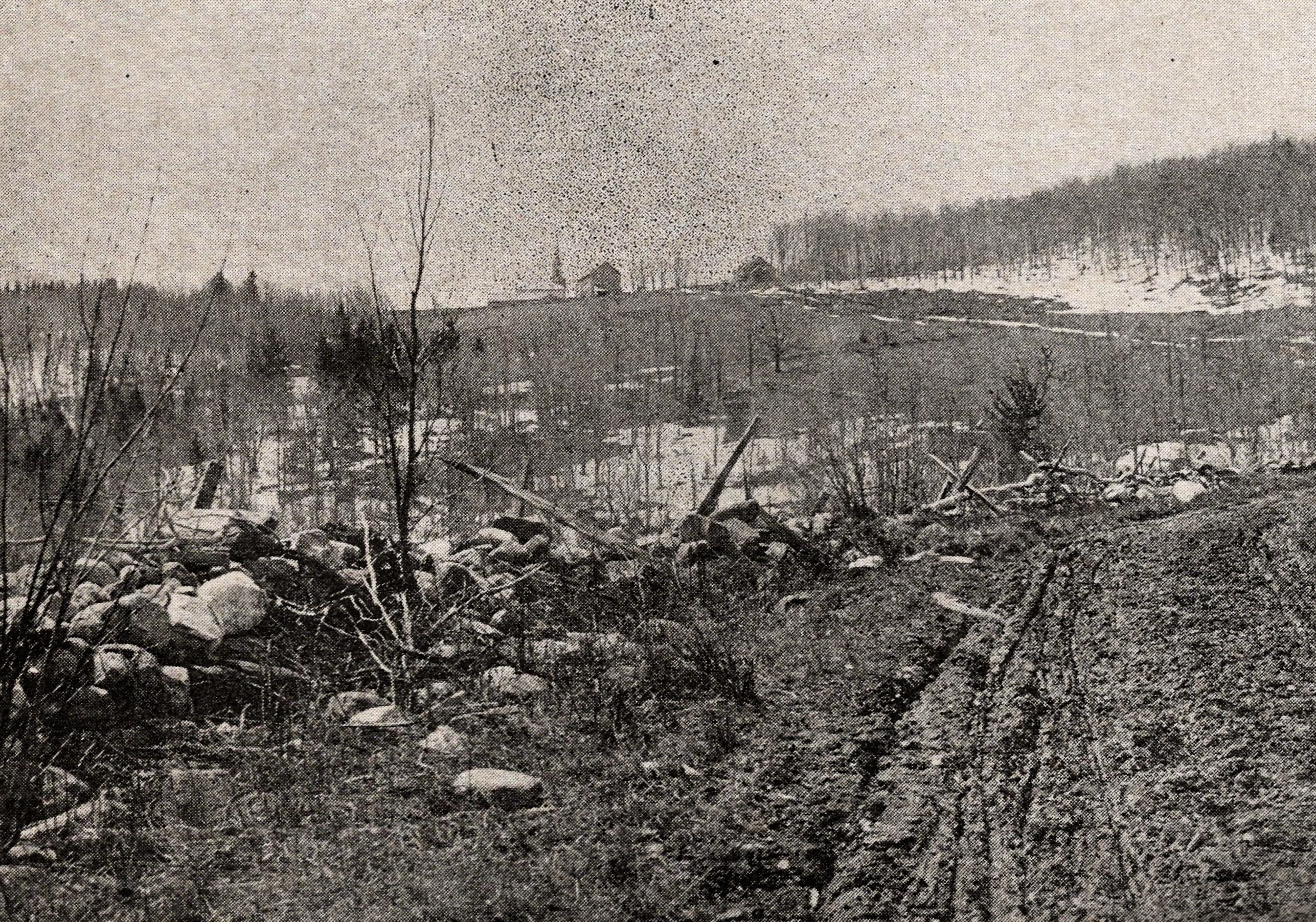 This image may show something a bit closer to what the Hand Hollow road looked like – a somewhat rough and muddy track. The fence along this rock wall has apparently not been maintained.
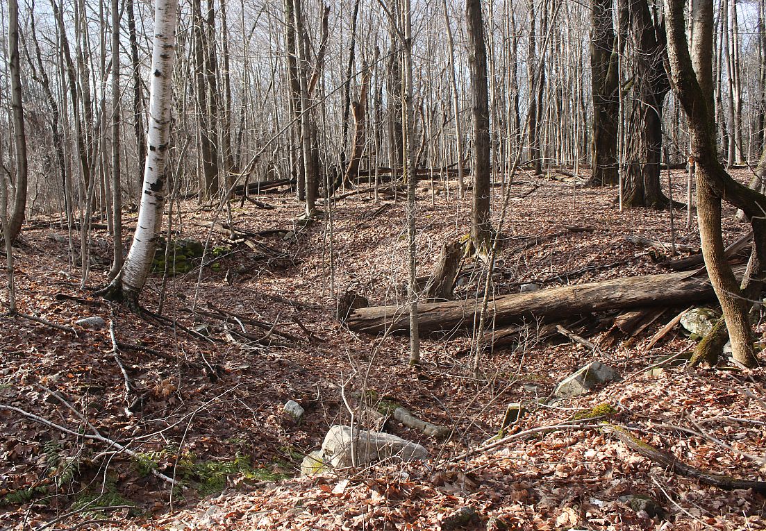
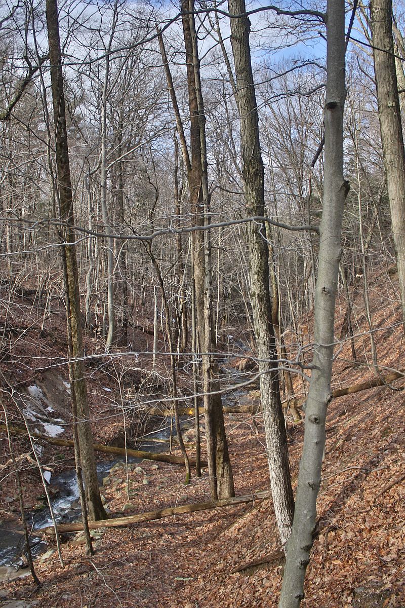 This photo looks north along the ravine that drains the pond. Much of the late 19th century forest in this area was apparently along this untillable stretch.
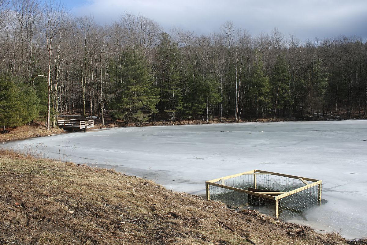 The pond itself, with DEC’s handicap-accessible dock and a beaver excluder around the pond drain in the foreground. The pond appears to have been constructed in the 1960s from what was once an extensive wetland. This is a common fate of regional wetlands.
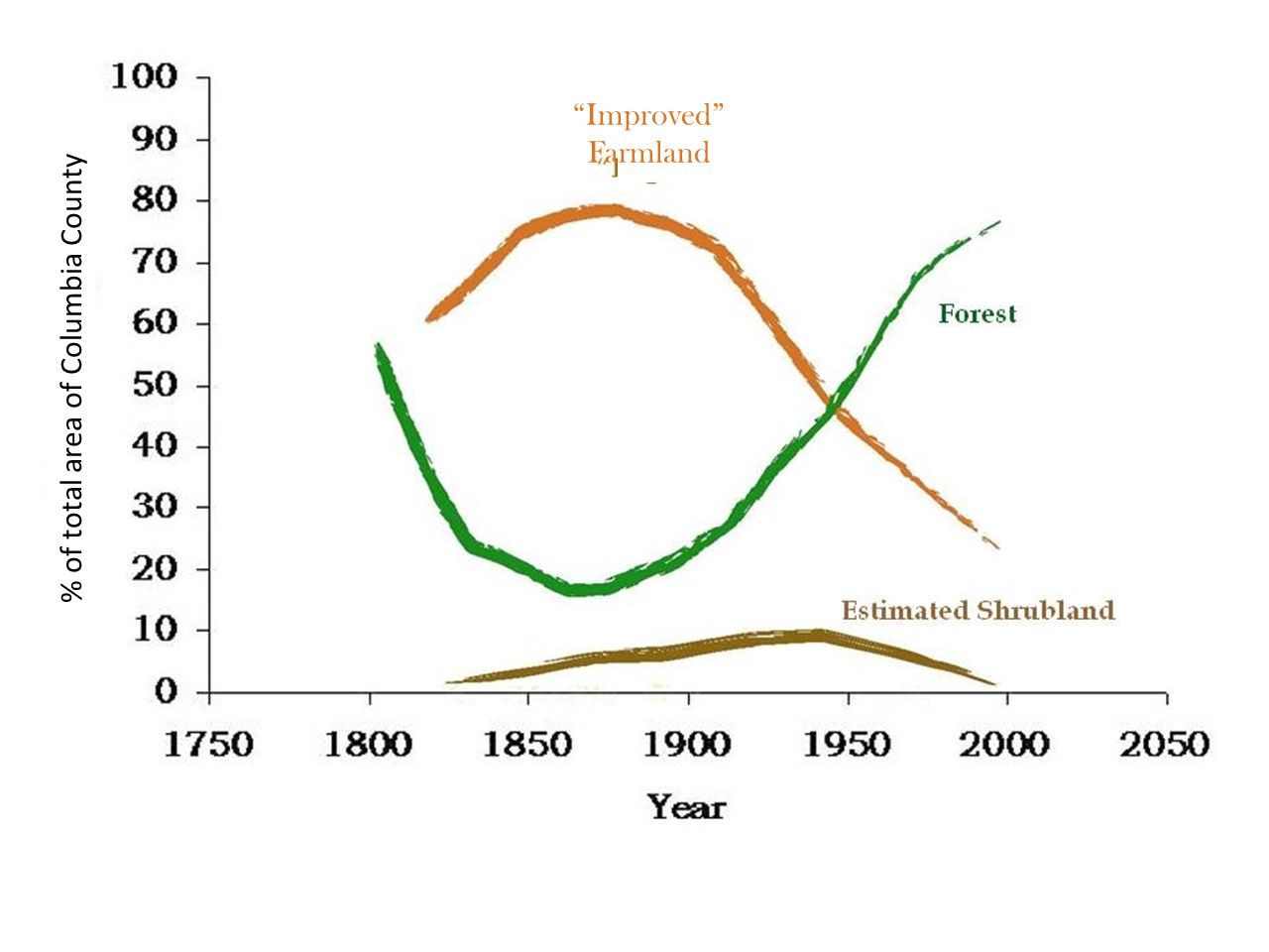 As background for what follows, it helps to quickly review forest history in Columbia County. As is true for much of the Northeast, opening for agriculture was widespread and peaked somewhere around 1875, when 70-80% of the County was open farmland.
Forest followed the reverse trajectory, bottoming out as farmland peaked, but then rebounding.
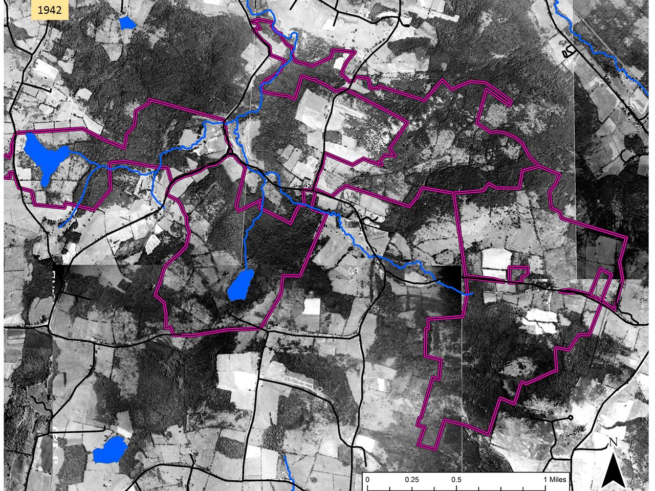 This aerial image from 1942, 50 years or more after maximum clearing, shows a landscape that might be about 50/50 farmland/forest. The purple lines show the approximate extent of the lands shown in the first map.
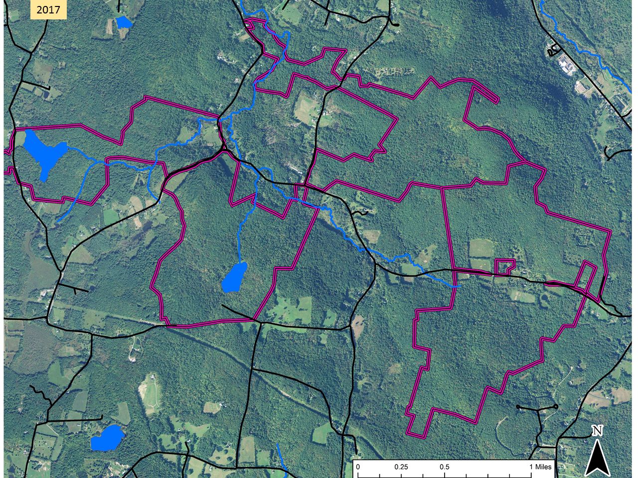 By 2017, farmland was the rare patch in a forest matrix.
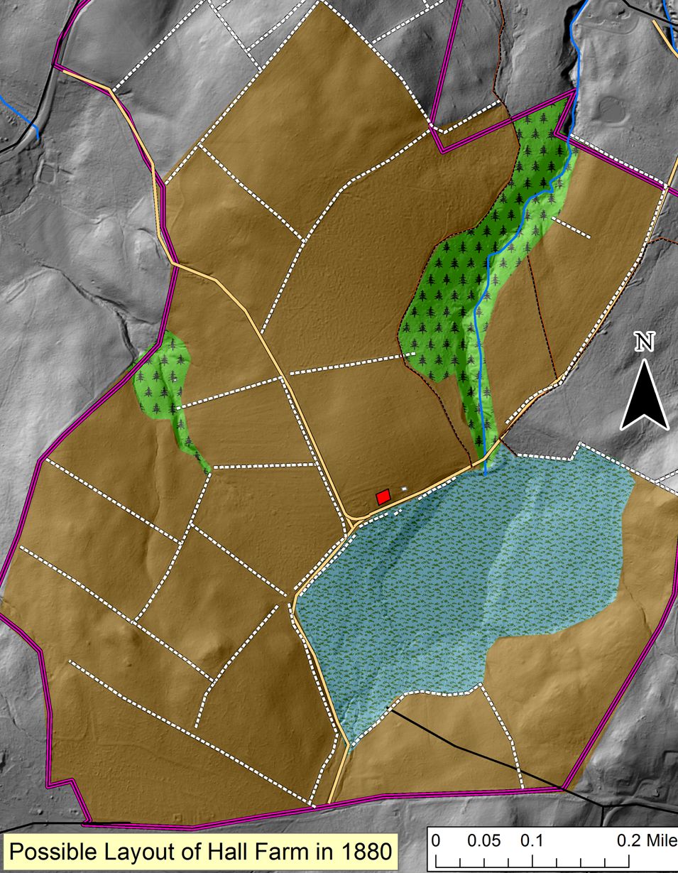 According to an early map, the foundation north of the pond was the home of A. Spencer Hall. Based on census information, walls and guesswork, we have created this sketch of his farm around 1880. This would have been a wide-open landscape composed mostly of fields. The wetland was probably a meadow grazed or hayed as conditions allowed.
This map is somewhat speculative but more or less fits the census information we have. Taking the time to find and plot the original deed would probably increase its accuracy.
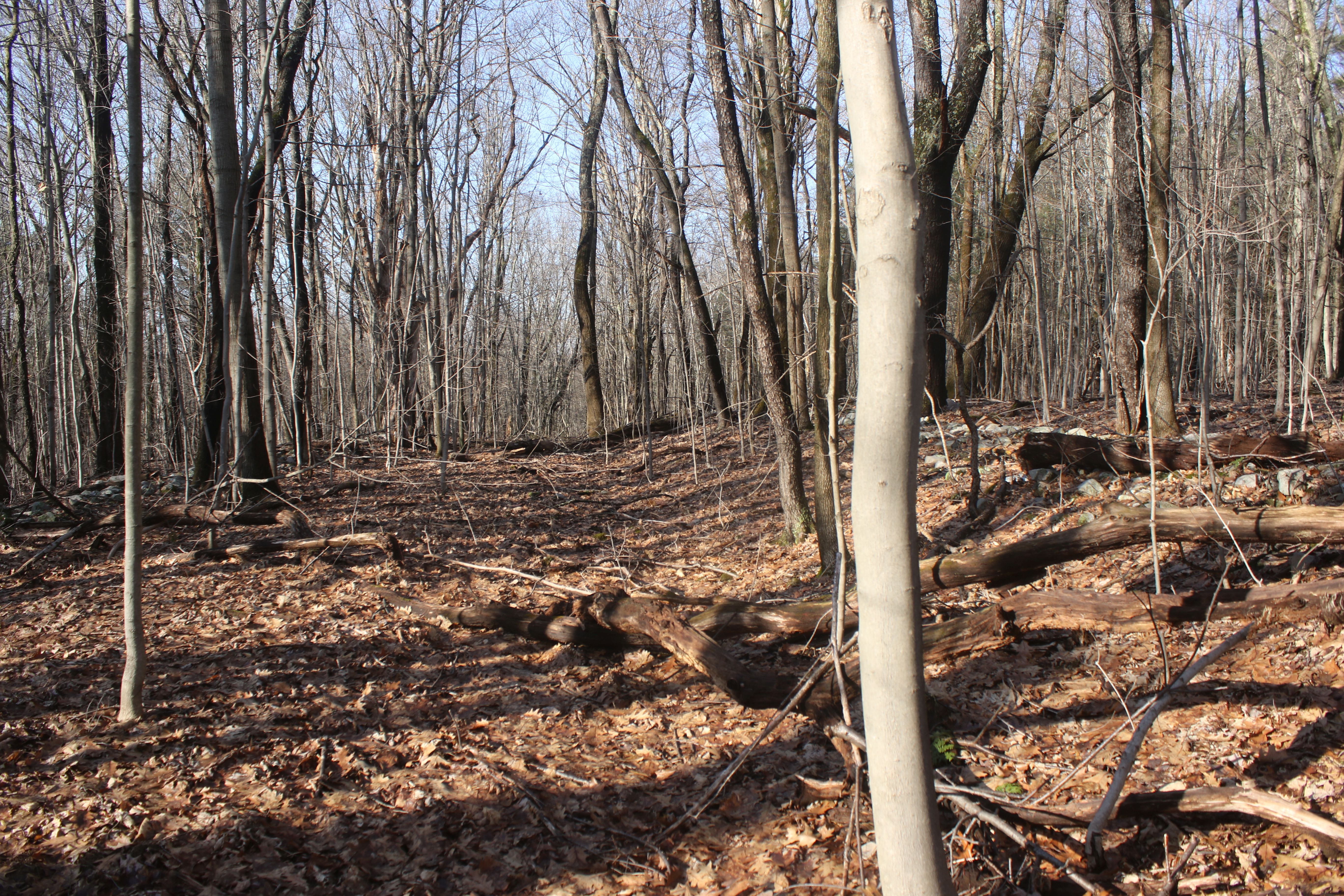
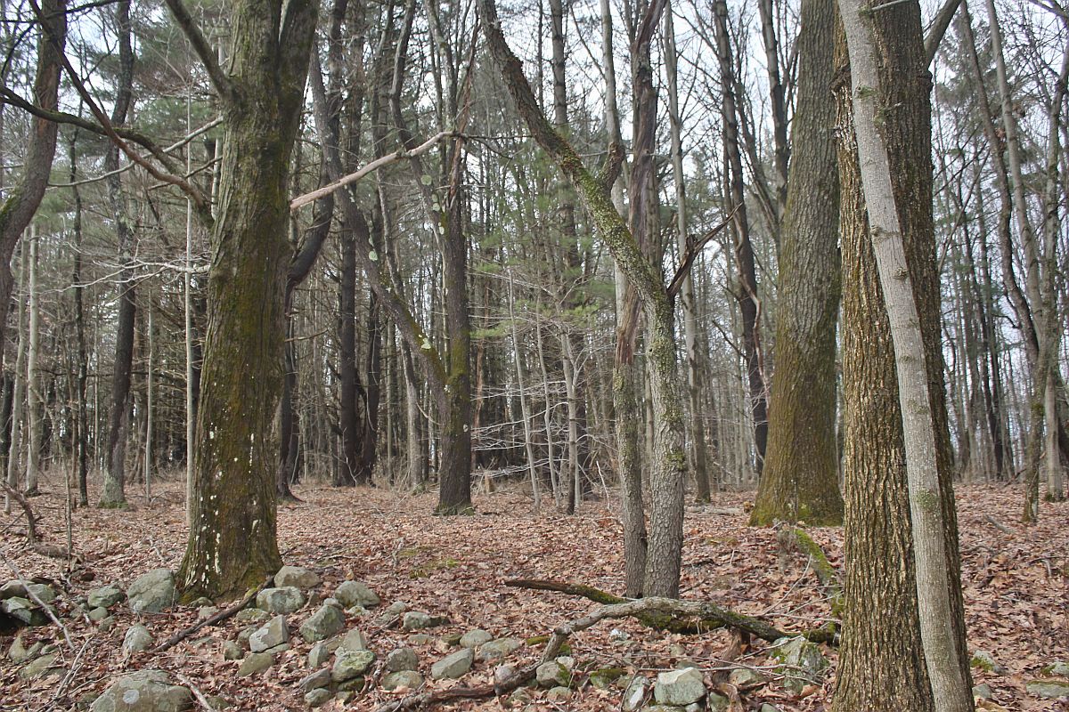 As one approaches the foundation from the northeast, the fact that one is walking through former fields becomes evident: flat ground surface, old-field White Pine and, although it’s somewhat hard to see here, an elevated plow terrace caused by years of plowing almost but not quite to the wall in the foreground.
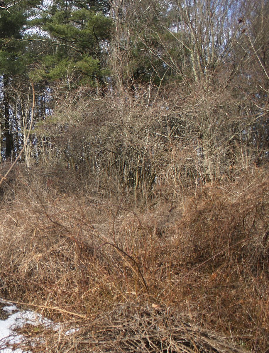 Just before one arrives at the foundation, one reaches this tangle of Honeysuckle – the most evident reminder that this was once somebody’s backyard.
 This is a sizable foundation with a stone-lined cellar. In the far corner, is a pile of bricks (a chimney?) while in the near corner a well hole seems to be attached to the house. Somebody familiar with the property told us that these and other bricks were made on-site. Judging by aerial imagery, the house probably disappeared in the third quarter of the 20th century.
 Just beyond the house is the crossroads where the two arms of the public road’s ‘Y’ meet. This photo looks northwest along the western arm.
 Below the house, a ca. 5’ high stone bank supports the road, presumably helping to prevent it from eroding into the wetland. In this picture, one’s back is to the pond, and the road runs along the ground which is even with the top of the rocks.
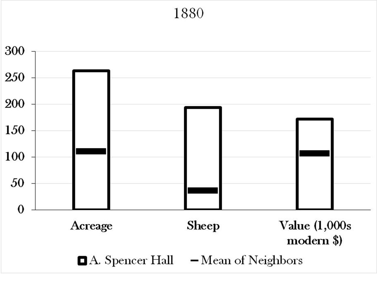 Spencer Hall’s farm was, according to the census records, not a particularly small or poor one. It had twice the average acreage of its neighbors, nearly ten times the number of sheep, and was valued about 40% above that of its average neighbor (at ca. $172,000 in modern currency).
In 1880, he also had 2 oxen, 3 horses, 4 milk cows and 6 pigs, and raised, together with hired help, barley, buckwheat, corn, oats, rye, and potatoes. He also had a couple of acres of orchard and cut 10 cords of wood.
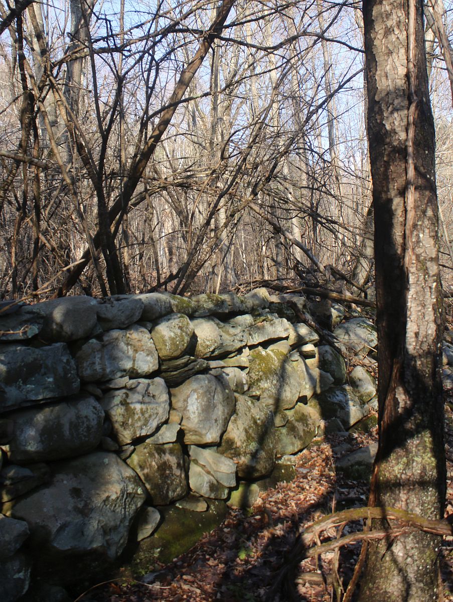
This rock wall, running along the northeast edge of the modern pond, may have not only margined a field, but also indicated a property line. It may have separated hay meadow from neighboring woodlot.
Today, a walk through this landscape still reveals much evidence of the worked land that once was, although any rail and crossposts fence atop these rocks has now rotted away. We are privileged – the history of work on the land is still quite evident in the landscape, it may well be more hidden in a century or so.